Rota Vicentina Trail Maps for Sagres Coastal Walks
Find the best Rota Vicentina trail maps for Sagres coastal walks. Plan your 2026 Portugal hiking adventure with these expert tips and route guides today!
On this page
Best Rota Vicentina Trail Maps for Sagres Coastal Walks
Finding Rota Vicentina trail maps for Sagres coastal walks is essential for your 2026 trip. These maps help you navigate the rugged cliffs of southern Portugal safely. You can discover stunning ocean views and hidden beaches along these marked paths. Start your journey at the iconic Sagres Fortress to see the wild Atlantic coast.
Essential Rota Vicentina Trail Maps for Sagres Coastal Walks
For the most up-to-date details, check Sagres travel info before you go.
To plan your trip, review Sagres travel info.
Digital maps are the most reliable way to navigate the Fisherman's Trail in Sagres. You should download offline maps before starting your hike near the dramatic cliffs. Many trails lack consistent mobile phone reception in remote coastal areas. A physical map serves as a great backup for long day trips.The official Rota Vicentina website offers detailed GPS tracks for every coastal section. These files work perfectly with popular hiking apps on your smartphone. You can also find printed maps at the local tourism office in Sagres. These resources ensure you stay on the new Rota Vicentina trails in Sagres safely.
Look for the blue and green trail markers along the rocky paths. These colors indicate the Fisherman's Trail which hugs the coastline closely. If you see red and white stripes, you are on the Historical Way. Maps will help you distinguish between these two main hiking routes.
You can also consult the Visit Portugal website for regional walking guides. They provide updated information on trail conditions across the entire country. Combining official maps with local advice ensures a smooth hiking experience. Always check for any temporary trail closures before you start your walk.
Top Coastal Routes Near Sagres for 2026
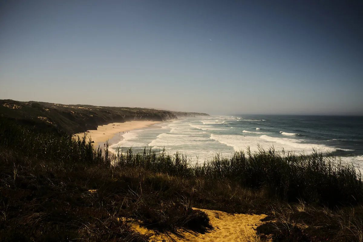
The walk from Sagres to Cabo de São Vicente is a local favorite. This 6-kilometer route offers breathtaking views of the southwestern tip of Europe. You will pass by the beautiful Beliche Beach along this sandy path. Most hikers complete this one-way walk in about two hours.
Another great option is the trail heading north toward Telheiro Beach. This section features some of the oldest rock formations in the entire region. You should check your best hiking routes near Sagres for 2026 visitors guide for details. The terrain here is rocky and requires sturdy hiking boots.
For a shorter walk, explore the paths around the Sagres Promontory. This area is home to unique plants that only grow in this climate. You can see the lighthouse and the famous wind compass during your walk. Entry to the main fortress area usually costs around 3 Euros.
Advanced hikers may enjoy the long trek toward Vila do Bispo. This route covers diverse landscapes including coastal scrubland and high cliffs. Ensure your map clearly shows the transition points between different trail types. This path offers incredible solitude away from the main tourist spots.
Practical Tips for Navigating Sagres Hiking Trails
💡 Pro Tip: Book your Lisbon adventures in advance through Viator for the best deals!
Safety is vital when walking along the steep cliffs of the Algarve. Always stay at least two meters away from the crumbling cliff edges. Strong winds can occur suddenly and affect your balance while hiking. Check the local weather forecast before you leave your hotel each morning.
Carry at least two liters of water for any hike over three hours. The sun is very strong in Sagres even during the cooler months. You will find very little shade along the coastal Fisherman's Trail. Wear a wide-brimmed hat and apply high-factor sunscreen frequently.
Learn about safety tips for coastal hiking in Sagres 2026 before you arrive. It is best to hike with a partner for added security. Tell someone at your accommodation which route you plan to take. This simple step ensures help can find you if an emergency happens.
Pack a small first aid kit with bandages and antiseptic wipes. Small scrapes from rocks or thorny bushes are common on these trails. Bring a fully charged power bank to keep your phone battery alive. You may need your GPS map for several hours during the day.
Best Time to Explore Sagres Coastal Paths
Spring is the perfect season for hiking the Rota Vicentina in Portugal. Wildflowers bloom across the clifftops during April and May each year. Temperatures remain mild and comfortable for long days of outdoor exercise. You will enjoy vibrant colors and fresh sea breezes during this time.
Autumn also offers excellent conditions for exploring the Sagres coastal walks. The summer heat fades by late September but the water remains warm. You can find more information in the best time of year for hiking in Sagres guide. Crowds are smaller during these months compared to the busy summer.
Winter hiking is possible but requires careful planning for rain and wind. January and February are the wettest months in the Algarve region. However, sunny winter days provide crisp air and incredible visibility for photography. Always bring a waterproof jacket if you hike during the winter season.
The Visit Algarve tourism board provides seasonal updates for all regional activities. They often list local walking festivals that take place in the spring. Hiking in the early morning is best if you visit during July. This helps you avoid the most intense heat of the day.
Frequently Asked Questions
Where can I find Rota Vicentina trail maps for Sagres coastal walks?
You can find official Rota Vicentina trail maps for Sagres coastal walks on the official Rota Vicentina website. They provide downloadable GPS files and PDF maps. Additionally, the Sagres tourism office provides physical maps for visitors. Local hotels often have printed route guides for their guests to use.
Are the Sagres coastal trails difficult for beginners?
The coastal trails around Sagres are generally considered moderate in difficulty. Most paths are well-marked but involve walking on sand and uneven rocks. Beginners should start with the shorter loops around the Sagres Promontory. Always wear proper hiking shoes to prevent slipping on the loose coastal terrain.
Is the Fisherman's Trail in Sagres well-marked?
Yes, the Fisherman's Trail is clearly marked with blue and green stripes. These markers appear frequently on rocks, posts, and walls along the route. However, using a digital map is still recommended for extra security. Some markers may be faded or obscured by vegetation in remote areas.
Using Rota Vicentina trail maps for Sagres coastal walks ensures a great trip. These tools help you explore the wild beauty of the Portuguese coast safely. Plan your 2026 hiking adventure today to see these amazing Atlantic views. Pack your boots and get ready for an unforgettable journey in Sagres.
Official resources
Use these sources for official schedules, tickets, routes, and updates.
- Município de Vila do Bispo — Local municipal government; unverified source.
- UNESCO World Heritage Centre — UNESCO Tentative List entry for Sagres Promontory; unverified source.
- Lonely Planet — Major editorial travel guide; unverified source.